NEWS


3rd Croatian NSDI and INSPIRE Day and 7th Conference Cartography and Geoinformation with international participation
Split, September 14-16, 2011

Where: Faculty of Civil Engineering, Architecture and Geodesy, Matice hrvatske 15, Split
When: September 14-16, 2011
Abstracts submission deadline: August 15, 2011.
Registration deadline: August 15, 2011
Registration fee: type A (280 EUR), type B (220 EUR), type C (140 EUR)
Excursion by ship, September 16, 2011
Accomodation: personally organized

Conference languages: English and Croatian

Invited lecturers:

  • Georg Gartner (International Cartographic Association)
  • Ulrich Boes (Association for Geospatial Information in South-East Europe)
  • Dusan Petrovic (Faculty of Civil and Geodetic Engineering, Ljubljana)
  • Temenoujka Bandrova (Bulgarian Cartographic Society, Sofia)
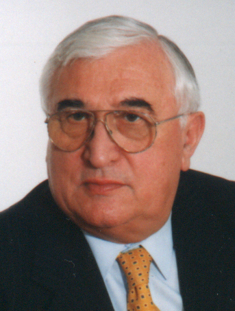
Prof. Drago Novak, M.D., renowned radiologist and scientist, passed away on Friday, March 26, 2011. He was a passionate collector of maps representing Croatia. He was also a co-editor of the monograph "Five Centuries of Maps and Charts of Croatia".

Conference program in PDF or HTML format.

Visit the conference web-site for more information on this event.

Photographs from the conference!

Presentations from the conference!


30. 06. 2010.

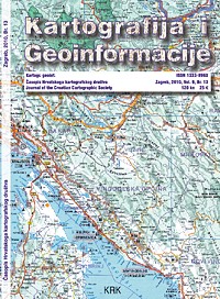
Issue 13 of the journal Cartography and Geoinformation is published.

Full texts are available for free on these pages and portal HRCAK.


In Memoriam

Jacques Bertin (1918 -- May 3, 2010) was a French cartographer and theorist, known from his book Semiologie Graphique (Semiology of Graphics), edited in 1967. This monumental work, based on his experience as a cartographer and geographer, represents the first and widest intent to provide a theoretical foundation to Information Visualization.

Wikipedia article on Jacques Bertin.


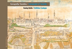
Croatian Cartographic Society published the catalogue Cartography of Varazdin. The catalogue is in English and Croatian, has 293 pages in full color on glossy paper, ISBN 978-853-95815-1-8, landscape A4 format and soft cover.

The price is 35 Euros (mail shipping included). For orders contact Prof. Dr. Miljenko Lapaine by e-mail: mlapaine@geof.hr.

Preview some of the content in PDF.


15. 12. 2009
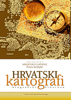
Biographical lexicon Croatian Cartographers was recently published by Golden marketing - Tehnicka knjiga. The editors are Prof. Dr. Miljenko Lapaine and Assist. Prof. Dr. Ivka Kljajic. The lexicon includes about 2000 people who contributed to Croatian cartography.


7. 12. 2009
The ICA Commission on Digital Technologies in Cartographic Heritage and Vienna University of Technology are organizing the 5th International Workshop on Digital Approaches in Cartographic Heritage in Vienna on February 22-24, 2010. Abstracts are accepted till December 15, 2009

Visit the workshop web-site http://cartography.tuwien.ac.at/cartoheritage/


Croatian Cartographic Society and State Geodetic Administration are organizing 1st Croatian NSDI and INSPIRE Day and Cartography and Geoinformation Conference in Varazdin, November 26-28, 2009.

All information on this event at the web-site of the 1st Croatian NSDI and INSPIRE Day and Cartography and Geoinformation Conference

The Conference Program (PDF).

Global SDI Sponsor


Geofoto d.o.o.

European SDI sponsors


Zavod za fotogrametriju d.d., Zagreb


IGEA d.o.o, Varaždin


GISDATA


Hydrographic Institute of the Republic of Croatia, Split

National SDI sponsors


Geomatika Smolčak


Geodetski zavod Rijeka


Geodetski zavod Split


Geodetski zavod Osijek


Meritum Soft d.o.o, Varaždin


T-Hrvatski Telekom

Sponsors


Varaždin City Tourist Association


County of Varaždin Tourist Association


10. 10. 2009
The Croatian Cartographic Society was founded on this day 8 years ago.


28. 1. 2009.
Invitation for Participation on the International Map Exhibition, Chile 2009

Within the scope of the 24th International Cartographic Conference, which will take place in Santiago de Chile, from November 15 to November 21, 2009, the International Cartographic Exhibition is about to be held. Cartographic institutions, organisations, institutes and cartographers are invited to present their latest work in the framework of this prestigious exhibition, which includes a special recognition for the best exhibits.

For more details read the invitation in PDF.


28. 08. 2008.
ICA Symposium on Cartography for Central and Eastern Europe in organization of the International Cartographic Society (ICA) and Vienna University of Technology will be held in Vienna, 16-17 February 2009.

Open the call for papers or visit the web-pages of symposium http://cartography.tuwien.ac.at/cee2009.


29. 09. 2008.
The Workshop on "Archiving in Digital Cartography and Geoinformation" will be held in Berlin, 4-5 December 2008. The workshop is organised by the Berlin-Brandenburg Section of the German Cartographic Society in cooperation with the ICA Commission on Digital Technologies in Cartographic Heritage, CODATA Germany, the German National Committee on Data for Science and Technology, and the Hasso Plattner Institute at the University of Potsdam.

Open the call for papers or visit the web-pages of workshop http://www.codata-germany.org/Archiving_2008/.


26. 09. 2008.
International symposium "Cartography and Geoinformatics in Early Warning and Emergency Management: Towards Better Solutions" will be held in Prague, January 19-22, 2009. It is a Joint Symposium of ICA Working Group on Cartography in Early Warning and Crises Management (CEWaCM) and JBGIS Geo-information for Disaster Management (Gi4DM).

Open the call for papers or visit the web-pages of symposium http://c4c.geogr.muni.cz/index.html.


28. 08. 2008.
State Geodetic Administration of the Republic of Croatia has published Geodesy and Geoinformatics Glossary (in Croatian) edited by Prof. emeritus N. Francula and Prof. M. Lapaine.


28. 08. 2008.
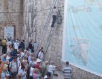
Megamap of the Dubrovnik and Neretva County is the largest printed map in the world according to Guinness Book of Records. Map is 11 meters wide and 6 meters high.