")
Natječaj Nagrade Barbara Petchenik 2025.
Hrvatsko kartografsko društvo objavljuje natječaj za dječje likovne radove 2025.
Cilj natjecanja je promoviranje dječje kreativnosti u prikazivanju svijeta, proširenje njihova znanja o kartama i kartografiji te povećanje njihove svijesti o okolišu.

Radove za natječaj treba donijeti osobno uz prethodnu najavu na jurica.jagetic@geof.unizg.hr s naslovom maila 'HKD natječaj za dječje likovne radove 2025' ili poslati preporučeno najkasnije do 1. travnja 2025. na adresu:
Za sve dodatne informacije obratite se e-poštom: jurica.jagetic@geof.unizg.hr s naslovom e-pošte 'HKD natječaj za dječje likovne radove 2025'.

Early Modern Nautical Charts: Information Sources, Navigation Means and Communication Media
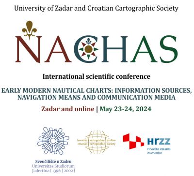
Više o konferenciji možete pročitati ovdje.
Sretan Božić i Nova 2024. godina
Hrvatsko kartografsko društvo osnovano je 10. 10. 2001.
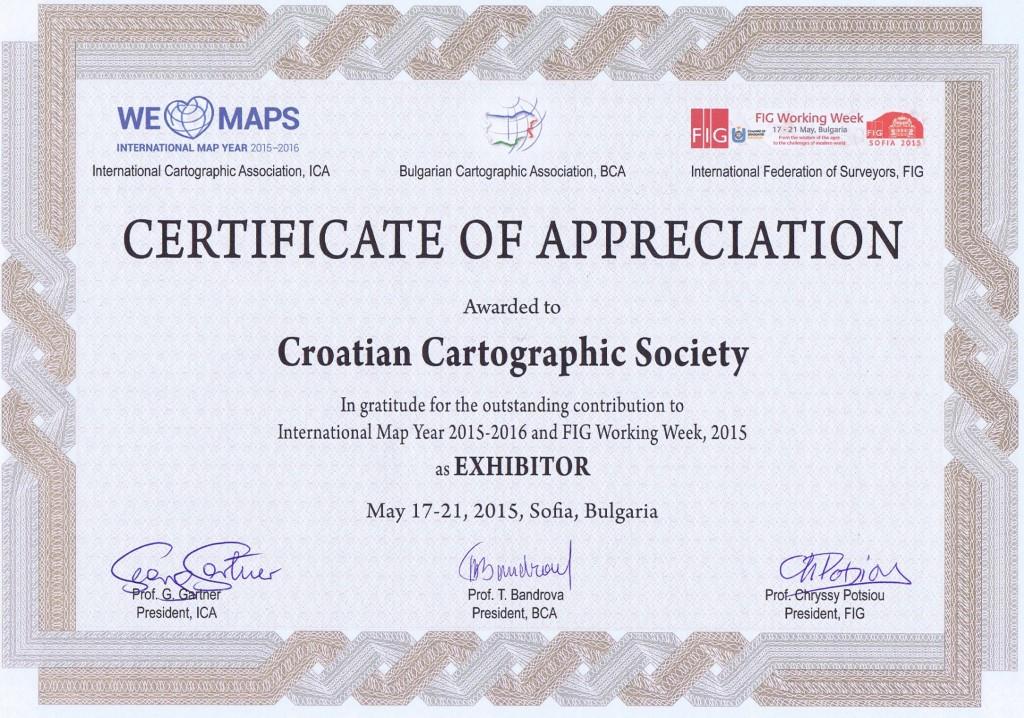
Međunarodna kartografska izložba
Prva nagrada Hrvatskoj za kartohod izrađen u Državnoj geodetskoj upravi. Međunarodna kartografska izložba, kategorija kartografski obrazovni proizvodi, Cape Town 2023.
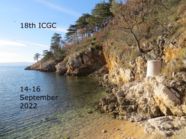
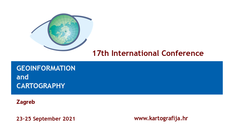
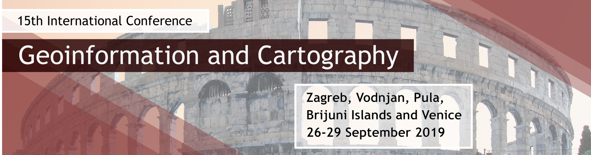
19th international conference Geoinformation and Cartography

Radionica Tematska kartografija u Osijeku 28.i 29. lipnja 2023.
Radionica je uvrštena u program stručnog usavršavanja nastavnika i učitelja te u program stručnog usavršavanja ovlaštenih inženjera geodezije, gdje je vrednovana s 8 akademskih sati.
Program radionice možete pogledati na web stranicama radionice.
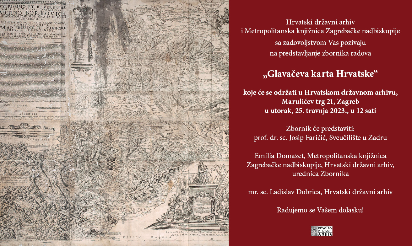
Predstavljanje Zbornika Glavačeva karta Hrvatske
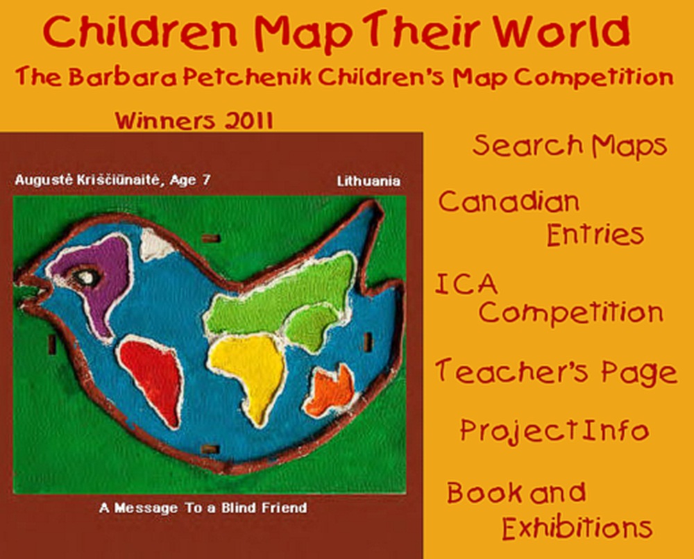
Hrvatsko kartografsko društvo objavljuje natječaj za dječju kartu
Cilj natjecanja je promoviranje dječje kreativnosti u prikazivanju svijeta, proširenje njihova znanja o kartama i kartografiji te povećanje njihove svijesti o okolišu.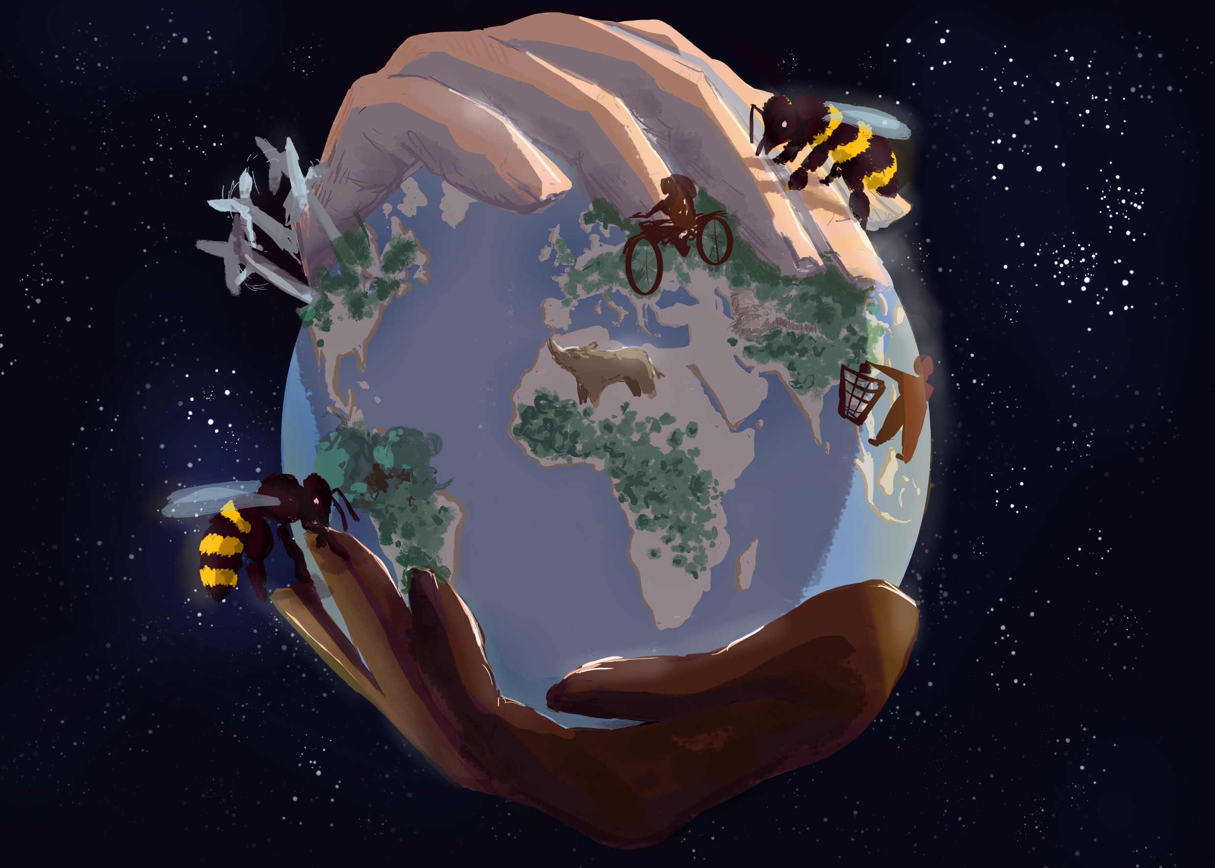
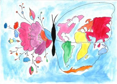
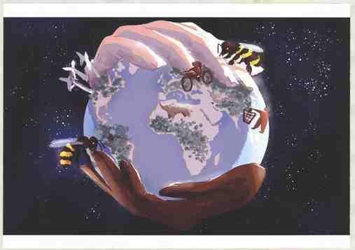
The planet of the future, Magda Oswald (12), OŠ Frana Krste Frankopana, Osijek
Radove za natječaj treba donijeti osobno uz prethodnu najavu na hkd@kartografija.hr ili poslati preporučeno najkasnije do 10. travnja 2023. na adresu
Hrvatsko kartografsko društvo
Međimurska 17
10000 Zagreb
Za sve dodatne informacije obratite se e-poštom: hkd@kartografija.hr
Šest najboljih dječjih radova iz Hrvatske na temu "Karta mojega budućeg svijeta" (A map pf my future world) bit će izloženo na izložbi dječjih radova u sklopu 31. međunarodne kartografske konferencije u Cape Townu u Južnoafričkoj Republici, 13–18. kolovoza 2023.
Više o natječaju pročitajte ovdje.
Obilježavanje izlaska posebnog broja časopisa Kartografija i geoinformacije
Kako bismo obilježili izlazak ovog posebnog broja, koji je u tiskanom izdanju izašao u siječnju 2023. i dostupan je online na stranicama Hrčka, Hrvatsko kartografsko društvo u suradnji s Geodetskim fakultetom Sveučilišta u Zagrebu poziva Vas na predavanja koja će se održati 1. veljače u 12 h u Vijećnici AGG Fakulteta, Kačićeva 26, Zagreb uz sljedeći program:
• Dr. sc. Dubravka Mlinarić, iz Instituta za migracije i narodnosti, i Petra Plantosar, asistentica s Odsjeka za povijest Filozofskoga fakulteta Sveučilišta u Osijeku
Uloga stranaca u razvoju predmoderne kartografije hrvatskih zemalja: primjer karte Lazarusa Secretariusa
• Prof. emer. Miljenko Lapaine
Umjetna inteligencija i kartografija
Nakon predavanja slijedi prigodni domjenak.
Molimo Vas da svoj dolazak potvrdite najkasnije do 25. siječnja 2023. na email: marina.vilicic@geof.unizg.hr
Veselimo se Vašem dolasku i srdačno Vas pozdravljamo,
Marina Viličić i Nedjeljko Frančula,
urednici posebnog broja
Sretan Božić i Nova 2023. godina
23. godišnja skupština Hrvatskoga kartografskog društva
23. godišnja skupština Hrvatskoga kartografskog društva održat će se u Vijećnici Geodetskog fakulteta u Zagrebu, Kačićeva 26, u četvrtak, 8. 12. 2022. s početkom u 17:00 sati uz ovaj predloženi dnevni red:1. Ovjera zapisnika s 22. godišnje skupštine (vidi KiG br. 36, str. 89–95)
2. Izvještaj predsjednika o radu HKD-a u 2022. godini
3. Financijski izvještaj za 2022. godinu
4. Izvještaj Nadzornog odbora
5. Plan rada za 2023. godinu
6. Financijski plan za 2023. godinu
7. Dodjela zahvalnica HKD-a
8. Ostalo
Dobro došli!
21. rođendan Hrvatskog kartografskog društva
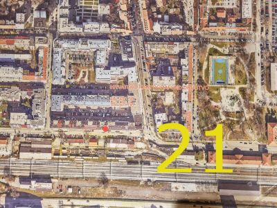
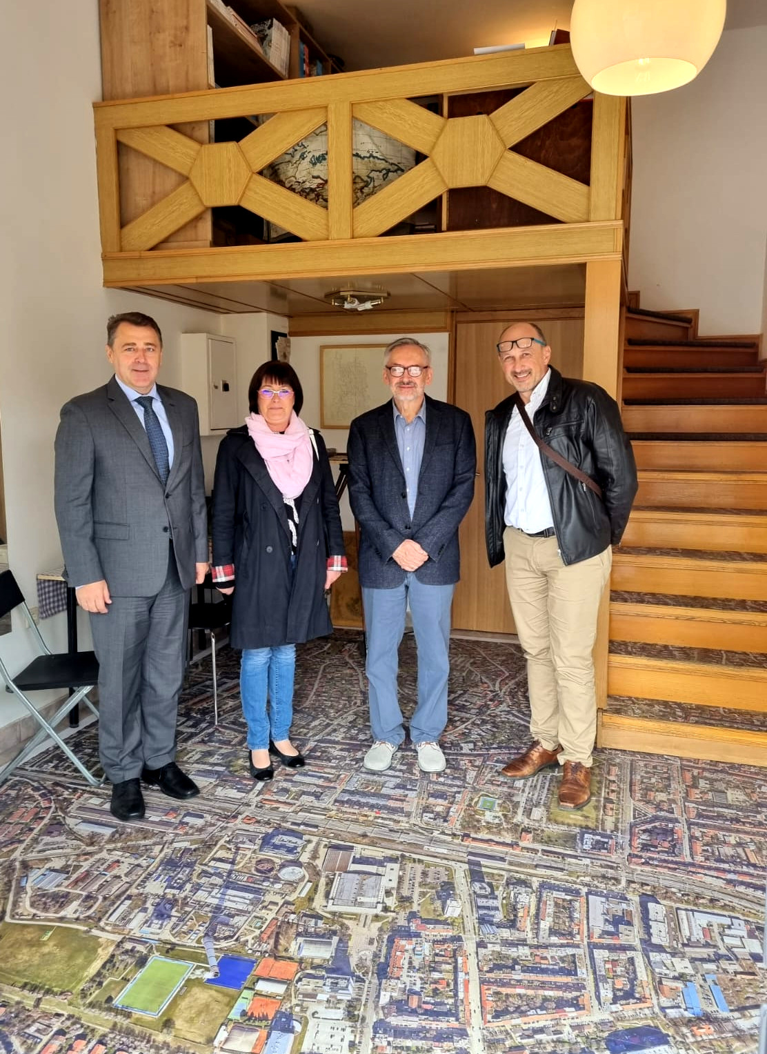
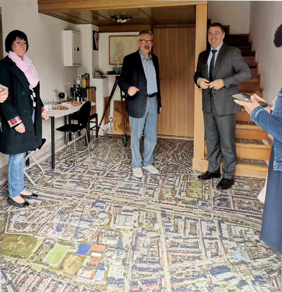
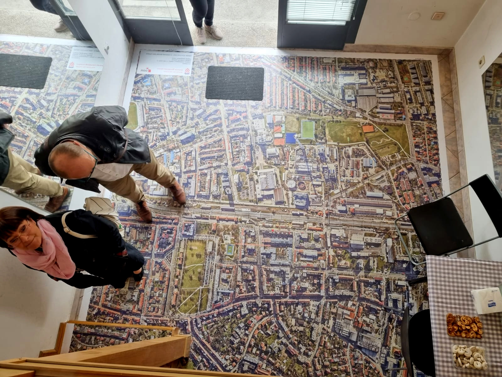
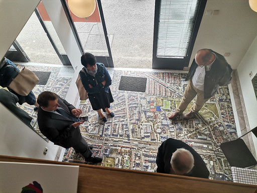
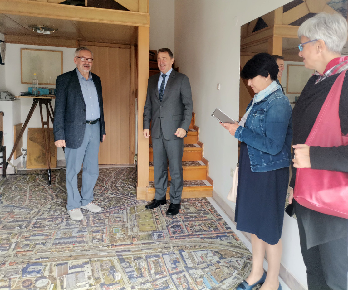
Na 21. rođendan HKD-a 10. 10. 2022. svečno je otvoren kartohod u novom prostoru HKD-a u Međimurskoj 17 u Zagrebu. Na svečanom otvorenju bili su:
- dr. sc. Damir Šantek, glavni ravnatelj DGU-a,
- izv. prof. dr. sc. Rinaldo Paar, predsjednik HGD-a,
- Adam Agotić, predsjednik HKOIG-a,
- prof. dr. sc. Damir Medak, prodekan za znanost i međunarodnu suradnju Geodetskog fakulteta,
- izv. prof. dr. sc. Mateo Gašparović, prodekan za financije Geodetskog fakulteta,
- dr. sc. Dubravka Mlinarić,
- dr. sc. Martina Triplat Horvat,
- dr. sc. Marina Viličić,
- mr. sc. Marija Brajković i
- Igor Vilus, dipl. ing. geod.
Glavni ravnatelj DGU-a predložio je da DGU izradi plakat koji bi se zalijepio na staklenu stijenu na ulazu u prostor HKD-a, M. Brajković je ponudila izradu ploče HKD-a koja bi se stavila pred ulaz HKD-a, a D. Mlinarić je ponudila održavanje predavanja koje bi zajedno sa svojim studentima održala za članove HKD-a.
Više o Hrvatskom kartografskom društvu možete pročitati u članku
"HKD - U povodu 20. obljetnice / On the Occasion of its 20th Anniversary" objavljenom u časopisu Kartografija i geoinformacije, 2022, vol. 21, br. 37, 87−99.
|
|
|
|
|
|
![IMG-a1668d08c7beee8f5d78ebd55101c376-V[1]](tl_files/Hkd/dogadjaji/21_rodjendan/7_IMG-a1668d08c7beee8f5d78ebd55101c376-V%5B1%5D.jpg)
|
18. međunarodna konferencija Geoinformacije i kartografija
Međunarodna kartografska konferencija u Firenci 2021
Magda Oswald osvojila je 2. mjesto u kategoriji od 9 do 12 godina na dječjem natjecanju za kartu svijeta na Međunarodnoj kartografskoj konferenciji u Firenci 2021. godine za svoj "Planet budućnosti".
22. godišnja skupština HKD-a
22. godišnja skupština HKD-a održat će se e-poštom zbog posebnih okolnosti.Materijale za sve točke dnevnoga reda možete preuzeti ovdje.
Molim Vas da ih proučite i javite svoje slaganje ili neslaganje, odnosno suzdržanost po bilo kojoj točki dnevnoga reda na hkd@kartografija.hr najkasnije do utorka, 7. 12. 2021. u ponoć.
Miljenko Lapaine
HKD, predsjednik
20. obljetnica Hrvatskoga kartografskog društva

 Kartografski rječnik
2500 naziva s definicijama
Istoznačnice na engleskom, njemačkom i francuskom
337 stranica
Tvrdo ukoričen
Nakladnici:
Hrvatsko kartografsko društvo
Dominović d.o.o.
Cijena: 290,00 HRK
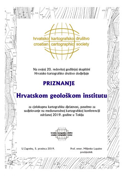
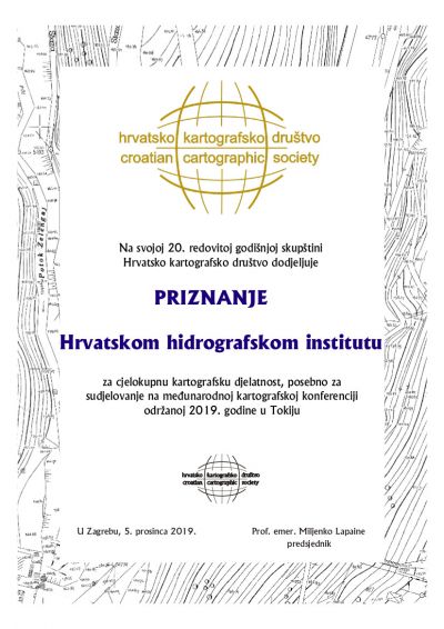
20. godišnja skupština Hrvatskoga kartografskog društva
održat će se 5. prosinca 2019. s početkom u 17:00 sati u Vijećnici AGG fakulteta, Kačićeva 26, u Zagrebu. Započet će predavanjem prof. emer. Miljenka Lapainea: Tokio 2019.
Prijedlog dnevnoga reda:1. Utvrđivanje dnevnoga reda
2. Ovjera zapisnika s 19. godišnje skupštine (vidi KiG br. 30, str. 130–135)
3. Izvještaj predsjednika o radu HKD-a u 2019. godini
4. Financijski izvještaj za 2019. godinu
5. Izvještaj Nadzornog odbora
6. Izbori tijela HKD-a za razdoblje 2020.–2021.
7. Plan rada za 2020. godinu
8. Financijski plan za 2020. godinu
9. Dodjela Zahvalnice i Priznanja HKD-a
10. Ostalo
Dobro došli!
18. rođendan /18th Birthday
 Hrvatsko kartografsko društvo osnovano je 10. listopada 2001. godine
Croatian Cartographic Society was founded on 10 October 2001
Cartography in Croatia 2015-2019
Ovdje možete preuzeti i pročitati Cartography in Croatia 2015-2019, National Report.
Rezultati natječaja za dječju kartu svijeta „Volimo karte“ u Hrvatskoj za 2019.

Obrana doktorskog rada Marine Viličić, dipl. ing. geod.
 Obrana doktorskog rada Marine Viličić, dipl. ing. geod., pod naslovom Kartografska analiza karte Stjepana Glavača iz 1673. godine, održat će se u petak 15. veljače 2019., u 12.00 sati u Vijećnici AGG.
Obavijest o obrani doktorskog rada možete pogledati ovdje.
Hrvatsko kartografsko društvo objavljuje natječaj za dječju kartu svijeta Volimo karte

Radove za natječaj treba poslati najkasnije do 15. ožujka 2019. na adresu koordinatorice za Hrvatsku:
Doc. dr. sc. Ivka Kljajić
Hrvatsko kartografsko društvo
Kačićeva 26
10000 Zagreb
Sve dodatne informacije mogu se dobiti na tel.: 01/ 46 39 481, faks: 01/ 48 28 081 ili e-poštom: ikljajic@geof.hr
Šest najboljih dječjih radova iz Hrvatske na temu "Volimo karte" (We love maps) bit će izloženo na izložbi dječjih radova u sklopu 29. međunarodne kartografske konferencije u Tokiju, 15–20. srpnja 2019.
Znanstveni kolokvij posvećen životu i djelu Vinka Paletina iz Korčule
Povodom 510. obljetnice rođenja Vinka Paletina Hrvatsko katoličko sveučilište, Hrvatska dominikanska provincija, Matica hrvatska i Udruga OS pozivaju Vas na Znanstveni kolokvij posvećen životu i djelu Vinka Paletina iz Korčule koji će se održati 7. studenoga 2018. na Hrvatskom katoličkom sveučilištu u Zagrebu, Ilica 242, s početkom u 10 sati.
Program možete pogledati ovdje.
Obrana doktorskog rada Dejana Lovrinčevića, dipl. ing. geod.

Obrana doktorskog rada Dejana Lovrinčevića, dipl. ing. geod., pod naslovom Nova metoda automatskog izbora dubina na navigacijskim pomorskim kartama, održat će se u petak 5. listopada 2018., u 12.00 sati u Vijećnici AGG.
Obavijest o obrani doktorskog rada možete preuzeti ovdje.
Godišnja skupština Hrvatskoga kartografskog društva
Godišnja skupština Hrvatskoga kartografskog društva održat će u petak, 16. ožujka 2018. s početkom u 17:00 sati u Vijećnici AGG fakulteta u Zagrebu, Kačićeva 26, prizemno lijevo, uz sljedeći program:
Na današnji dan ...
Hrvatsko kartografsko društvo čestita svjetski dan GIS-a!
Hrvatsko kartografsko društvo u skladu s Pravilnikom o nagrada HKD-a objavljuje
NATJEČAJ
za dodjelu nagrada Hrvatskoga kartografskog društva.
Prijedlog za pokretanje postupka za dodjelu nagrade HKD-a može dati član HKD-a. Prijedlog se podnosi Predsjedništvu HKD-a najkasnije do 31. 12. 2017. na obrascu koji je sastavni dio Pravilnika o nagradama. Prijedlog dobitnika nagrade Predsjedništvo će uputiti Skupštini HKD-a koja će na svojem godišnjem zasjedanju proglasiti dobitnike i dodijeliti nagrade.
U Zagrebu, 13. 9. 2017.
Rezultati natječaja za dječju kartu svijeta „Volimo karte“ u Hrvatskoj za 2017.
Poštovani prijatelji kartografije,
pozivam Vas na Godišnju skupštinu HKD-a koju ćemo održati u petak, 17. ožujka 2017. u 18:00 sati u predavaonici 119 na 1. katu Geodetskog fakulteta u Zagrebu, Kačićeva 26, uz sljedeći program:
Predavanje prof. dr. sc. Miljenka Lapainea:
2017. – godina značajnih obljetnica za geodeziju, astronomiju, geofiziku i kartografiju
Nakon predavanja slijedi
17. godišnja skupština HKD-a
Prijedlog dnevnoga reda
1. Utvrđivanje dnevnoga reda
2. Ovjera zapisnika s 15. godišnje skupštine (vidi KiG br. 25, str. 150–157) i 16. izvanredne skupštine (vidi www.kartografija.hr)
3. Izvještaj predsjednika o radu HKD-a u 2016. godini
4. Financijski izvještaj za 2016. godinu
5. Izvještaj Nadzornog odbora
6. Plan rada za 2017. godinu
7. Dodjela zahvalnica HKD-a
8. Dodjela Nagrade HKD-a
9. Ostalo
Otvaranje izložbe "200 godina Franciskanskog katastra" u galeriji na 1. katu Geodetskog fakulteta
U očekivanju Vašeg dolaska srdačno pozdravljam,
prof. dr. sc. Miljenko Lapaine
predsjednik HKD-a
U petak, 9. prosinca 2016. na Geodetskom fakultetu, u 12.00 sati, mr. sc. Branko Puceković, javno brani doktorski rad pod naslovom "Novi kriteriji za poboljšanje kvalitete topografskih karata".
Obrana će se održati u predavaonici 120/I. kat pred Povjerenstvom u sastavu:
- Prof. dr. sc. Stanislav Frangeš
- Doc. dr. sc. Ivka Kljajić
- Doc. dr. sc. Dušan Petrovič, Univerza v Ljubljani, Fakulteta za gradbeništvo in geodezijo
Više informacija možete pronaći ovdje.
Hrvatsko kartografsko društvo objavljuje natječaj za dječju kartu svijeta Volimo karte

Dođi prijatelju, čekam te s kartom! / Come my friend, I am waiting for you with the map!
Anja Aničić, 9 god., Osnovna škola Viktora Cara Emina, Lovran
Radove za natječaj treba poslati najkasnije do 17. ožujka 2017. na adresu koordinatorice za Hrvatsku:
Doc. dr. sc. Ivka Kljajić
Hrvatsko kartografsko društvo
Kačićeva 26
10000 Zagreb
Sve dodatne informacije mogu se dobiti na tel.: 01/ 46 39 481, faks: 01/ 48 28 081 ili
e-poštom: ikljajic@geof.hr
Šest najboljih dječjih radova iz Hrvatske na temu "Volimo karte" (We love maps) bit će izloženo na izložbi dječjih radova u sklopu 28. međunarodne kartografske konferencije u Washingtonu D.C., 2–7. srpnja 2017.
OSM Geo Awareness Week - Missing Map Mapathlon
OSGL Geodetskog fakulteta, Hrvatsko kartografsko društvo i IT-sekcija Studentskog zbora Geodetskog fakulteta pozivaju Vas na druženje i učenje u sklopu OsmGeoWeek radionice na kojoj ćemo kartirati u OpenStreetMapu za humanitarne svrhe.
Radionicu organiziramo kao dio tjedna geografije, uz međunarodni dan GIS-a i 12. savjetovanje Kartografija i geoinformacije, 17. 11. 2016. s početkom u 17:30 sati u predavaonici 118 na Geodetskom fakultetu Sveučilišta u Zagrebu, Kačićeva 26.
Za sudjelovanje je potrebno obaviti prijavu i ponijeti vlastito prijenosno računalo.
Pridružite nam se. Ulaz slobodan. Broj sudionika je ograničen na 40.
Radionica OSGL-a: SLAM (Simultaneous Localization and Mapping)

Laboratorij za slobodne geoinformacije i programe (OSGL) Geodetskog fakulteta Sveučilišta u Zagrebu poziva vas na predavanje i demonstraciju na temu simultanog određivanja položaja i kartiranja (SLAM, Simultaneous Localization and Mapping) što će se održati u srijedu 26. 10. 2016. s početkom u 12 sati u predavaonici 120, Kačićeva 26, Zagreb.
Program:
12:00 - 12:20 L. Redovniković: Metode i izazovi pri izmjeri špilja
12:20 - 12:40 D. Gajski: Kako radi simultano određivanje položaja i kartiranje?
12:40 - 13:00 D. Tutić i L. Redovniković: Demonstracija uživo sustava LSD-SLAM
Radionica je namijenjena studentima, nastavnicima, stručnjacima i svima zainteresiranima. Ulaz slobodan. Dobrodošli!
“Geo4All” Lab of the Month – Sveučilište u Zagrebu, Hrvatska

Laboratorij za slobodne geoinformacije i programe (Open Source Geospatial Lab, OSGL) Geodetskog fakulteta Sveučilišta u Zagrebu predstavljen je na stranicama Povjerenstva za slobodne geoinformacijske tehnologije Međunarodnoga kartografskog društva.
Prikaz će biti dostupan i u novostima globalne inicijative "GeoForAll" čiji je cilj osnažiti primjenu slobodnih geoinformacija i softvera te povezati sveučilišta, gospodarstvo i vladu u primjeni slobodnih tehnologija u prostornoj domeni.
Hrvatsko kartografsko društvo u skladu s Pravilnikom o nagrada HKD-a objavljuje
NATJEČAJ
za dodjelu nagrada Hrvatskoga kartografskog društva.
Prijedlog za pokretanje postupka za dodjelu nagrade HKD-a može dati član HKD-a. Prijedlog se podnosi Predsjedništvu HKD-a najkasnije do 31. 12. 2016. na obrascu koji je sastavni dio Pravilnika o nagradama. Prijedlog dobitnika nagrade Predsjedništvo će uputiti Skupštini HKD-a koja će na svojem godišnjem zasjedanju proglasiti dobitnike i dodijeliti nagrade.
U Zagrebu, 5. 7. 2016.
Sirijska izbjeglička kriza u Europi
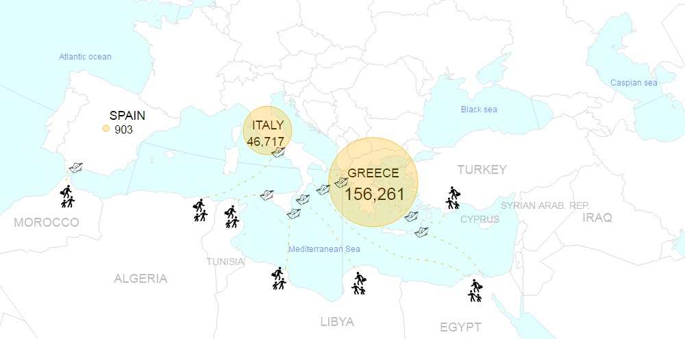
Kartografsku vizualizaciju izradili su studenti iz predmeta Multimedijska kartografija na Geodetskom fakultetu Sveučilišta u Zagrebu, 2015/16
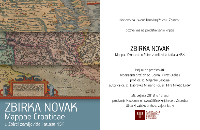
![]() Objavljena je Digitalna knjižnica NSK na mrežnoj adresi: http://digitalna.nsk.hr/ . Dostupno je do sada unesenih više od 600 jedinica kartografske građe te drugi fondovi NSK. Karte je moguće pregledavati u visokoj rezoluciji. Dostupne su sve karte iz Zbirke Novak objavljene prije 1945., stare karte Hrvatske i susjednih zemalja od XVI. do XIX. stoljeća, nekoliko planova hrvatskih gradova, Napoleonov atlas s izvješćem i nekoliko rukopisnih karata.
Objavljena je Digitalna knjižnica NSK na mrežnoj adresi: http://digitalna.nsk.hr/ . Dostupno je do sada unesenih više od 600 jedinica kartografske građe te drugi fondovi NSK. Karte je moguće pregledavati u visokoj rezoluciji. Dostupne su sve karte iz Zbirke Novak objavljene prije 1945., stare karte Hrvatske i susjednih zemalja od XVI. do XIX. stoljeća, nekoliko planova hrvatskih gradova, Napoleonov atlas s izvješćem i nekoliko rukopisnih karata.

Srijeda, 20. 4. 2016.
10.30 - 11.30 Kartografija - znanost i umjetnost predočavanja prostora (Vesna Poslončec-Petrić i Stanislav Frangeš)
12.00 - 12.30 Internet - izvor prostornih podataka (Ivka Kljajić)
12.00 - 13.00 Karta Zagreba u akvarelu - suptilniji pogled na digitalne karte (Ana Kuvedžić Divjak)
13.00 - 13.45 Leonardo da Vinci i kartografija (Branko Puceković)
13.30 - 14.00 Likovni elementi na karti Hrvatske Stjepana Glavača iz 1673. godine (Marina Viličić i Miljenko Lapaine)
17.15 - 18.15 Umjetnost i kartografija - kartografija i umjetnost (Miljenko Lapaine)
Dobro došli!
pozivam Vas i Vaše suradnike da nam se pridružite u petak, 18. ožujka 2016. u 12:00 sati u Vijećnici AGG fakulteta u Zagrebu, Kačićeva 26, prizemno lijevo, uz sljedeći program:
Nakon predavanja slijedi 15. godišnja skupština HKD-a s ovim prijedlogom dnevnoga reda:
1. Utvrđivanje dnevnoga reda
2. Ovjera zapisnika s 13. godišnje skupštine (vidi KiG br. 23, str. 140-145) i 14. izvanredne skupštine (vidi www.kartografija.hr)
3. Izvještaj predsjednika o radu HKD-a u 2015. godini
4. Financijski izvještaj za 2015. godinu
5. Izvještaj Nadzornog odbora
6. Izbori tijela HKD-a za razdoblje 2016-2017.
7. Plan rada za 2016. godinu
8. Dodjela zahvalnice HKD-a
9. Dodjela Nagrade HKD-a
10. Ostalo
Otvaranje izložbe "Ruđer Bošković, europski geodet 2016." u galeriji na 1. katu Geodetskog fakulteta
Domjenak
U očekivanju Vašeg dolaska srdačno pozdravljam,
prof. dr. sc. Miljenko Lapaine
predsjednik HKD-a
Simpozij o inženjerskoj geodeziji (SIG 2016)


Hrvatsko geodetsko društvo, u suradnji s Geodetskim fakultetom Sveučilišta u Zagrebu, organizira SIG 2016 – Simpozij o inženjerskoj geodeziji, koji će se održati u
Varaždinu, od 20. do 22. svibnja 2016. godine.
Više možete pročitati na internetskim stranicama konferencije i u dokumentu u prilogu.
14. izvanredna skupština HKD-a
Poštovani članovi Hrvatskoga kartografskog društva,
molim Vas za razumijevanje i suradnju. Ministar financija RH donio je 22. 10. 2015. Pravilnik o sustavu financijskog upravljanja i kontrola te izradi i izvršavanju financijskih planova neprofitnih organizacija. Prema čl. 27 navedenoga Pravilnika neprofitne organizacije moraju donijeti financijski plan za 2016. godinu do 31. 12. 2015.
Budući da se financijski plan donosi na Skupštini, to sam na temelju čl. 22 Statuta HKD-a odlučio da se o usvajanju financijskog plana HKD-a za 2016. godinu glasuje elektroničkim putem izvan zasjedanja Skupštine.
Izjašnjavanje se provodi osobno temeljem pozivnice koju ćete dobiti u e-pošti s pomoću servisa Eventbrite. Potrebno se registrirati, tj. izabrati jednu opciju "Za", "Protiv" ili "Suzdržan/a", te potom upisati ime i prezime i potvrditi registraciju. Izjašnjavanje nije tajno već je povezano s Vašim elektroničkim identitetom.
Unaprijed zahvaljujem na suradnji, želim Vam ugodne blagdanske dane te puno zdravlja i svako dobro u novoj godini,
Miljenko Lapaine
Hrvatsko kartografsko društvo, predsjednik
P.S. Rok za glasovanje je produžen do 2. 1. 2016. u 12 sati.
Prilog: financijski plan
Dragi prijatelji kartografije,
pozivamo Vas da dođete u utorak, 15. 12. 2015. na Geodetski fakultet u Zagrebu, Kačićeva 16, 1. kat, na kartografsko druženje sa sljedećim sadržajem:
Tvrtko Korbar: Nova Osnovna geološka karta RH 1:50000 - Otok Hvar (Oštrić i sur. 2015), prezentacija
Dražen Tutić: Kartografija i geoinformacije, br. 23, promocija časopisa
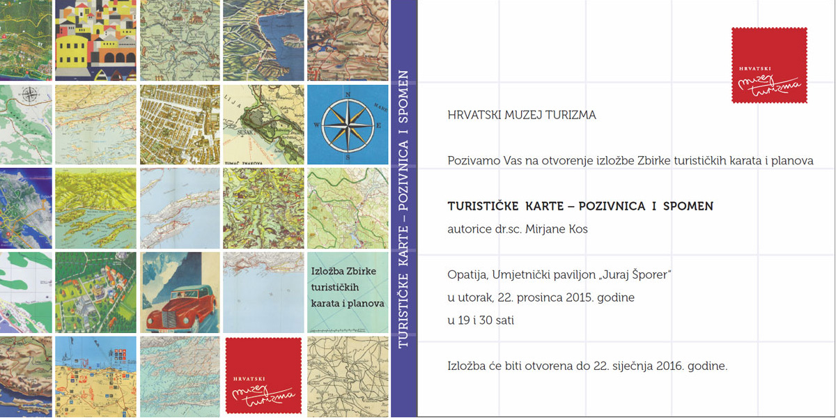
Mirko Alilović: Hercegovina na kartama i planovima, otvorenje izložbe
Domjenak
Početak u 18 sati.
Završetak oko 19:30.
Dobro došli!
 HrOSM, HrOSGeo, IT-sekcija Studentskog zbora Geodetskog fakulteta i OSGL Geodetskog fakulteta pozivaju Vas na druženje i učenje u sklopu OsmGeoWeek radionice na kojoj ćemo kartirati u OpenStreetMapu za humanitarne svrhe.
Radionicu organiziramo kao dio tjedna geografije, na međunarodni dan GIS-a, 18. 11. 2015. s početkom u 17:00 sati na Geodetskom fakultetu Sveučilišta u Zagrebu, Kačićeva 26.
Za sudjelovanje je potrebno obaviti prijavu i ponijeti vlastito prijenosno računalo.
Pogledajte detaljni program i pridružite nam se. Ulaz slobodan. Broj sudionika je ograničen na 50.
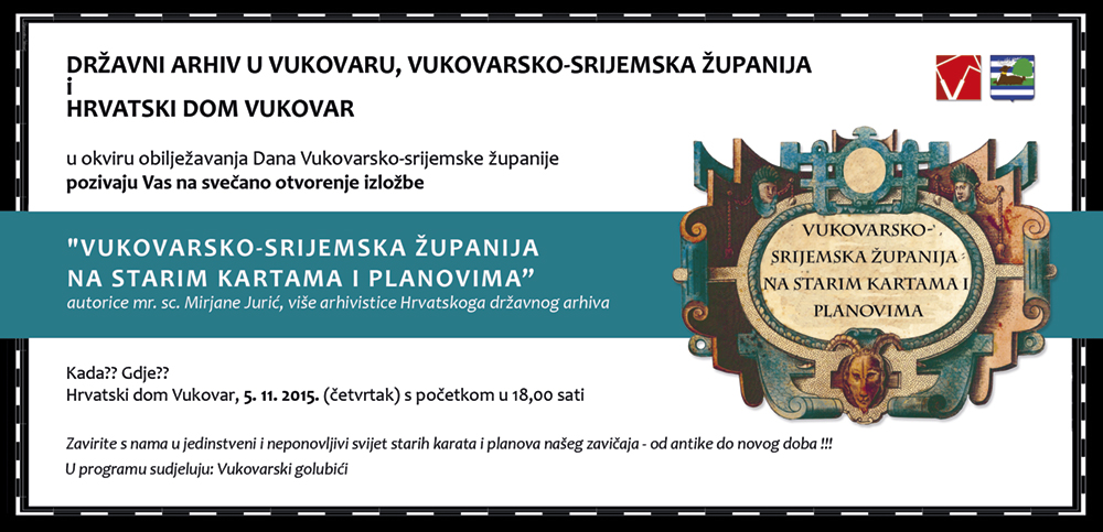

U utorak 20. 10. 2015. u 11 sati u predvorju žute zgrade Šumarskog fakulteta u Zagrebu, Svetošimunska cesta 25, otvorenje izložbe "Šumarske karte i planovi - iz povijesti gospodarenja šumama Hrvatske".
Dobro došli!
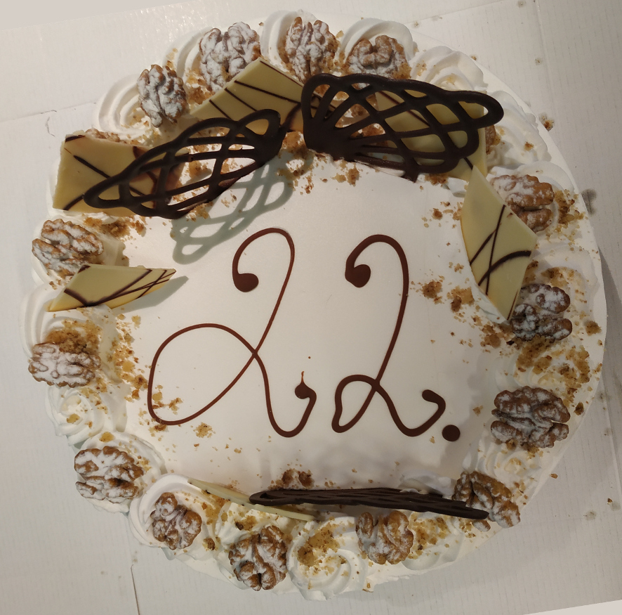
Proslava 14. rođendana Hrvatskoga kartografskog društva

Poštovani prijatelji kartografije,
Pozivamo Vas i Vaše suradnike na proslavu 14. rođendana Hrvatskoga kartografskog društva koja će se održati u ponedjeljak 12. 10. 2015. s početkom u 18:00 sati na Geodetskom fakultetu u Zagrebu, Kačićeva 26, 1. kat, predavaonica 119.
Program
ICC2015 i hrvatska kartografija (predavanje)
Razgledavanje izložbe Iž i Rava na kartama
Domjenak s rođendanskim kolačem
Karta na poklon
Dobro došli!
Novosti i obavijesti