Program 12. savjetovanja o kartografiji i geoinformacijama
Srijeda, 16. 11. 2016.
9:00 - 10:00 Prijava / registracija sudionika
10:00 - 11:00 Svečano otvaranje i stanka za osvježenje
|
11:00 - 11:30
|
Joep Crompvoets
|
Upravljanje za Pametni Svijet
sažetak (.pdf), prezentacija (.pdf)
|
|
11:30–11:45
|
Franka Grubišić
|
Kartografija i proširena stvarnost: Pokémon GO
sažetak (.pdf), prezentacija (.pdf)
|
|
11:45–12:00
|
Gojko R. Nikolić, Goran Barović, Duško Vujačić
|
Crna Gora u Međunarodnom sustavu zaštite i upravljanja georaznolikošću i u Europskoj asocijaciji za konzervaciju geološkog nasljeđa ProGeo
sažetak (.pdf), prezentacija (.pdf)
|
|
12:00–12:15
|
Goran Barović, Duško Vujačić, Velibor Spalević
|
Riječna mreža Crne Gore u GIS bazi podataka
sažetak (.pdf), prezentacija (.pdf)
|
|
12:15–12:30
|
Gojko R. Nikolić, Goran Barović, Duško Vujačić
|
Georaznolikost i geonasljeđe na Studijskom programu za geografiju Univerziteta Crne Gore
sažetak (.pdf), prezentacija (.pdf)
|
|
12:30–12:45
|
Dora Tomić Reljić, Vesna Koščak Miočić-Stošić, Sonja Butula, Goran Andlar
|
GIS u obrazovanju krajobraznih arhitekata
sažetak (.pdf), prezentacija (.pdf)
|
|
12:45–13:00
|
Tomislav Golubić, Sanja Benaković
|
Uvođenje novog nastavnog predmeta Geoinformatika u srednjoj školi
sažetak (.pdf), prezentacija (.pdf)
|
|
13:00–13:15
|
Mihaela Maček
|
Digitalna kartografija u gimnazijskom obrazovanju
sažetak (.pdf), prezentacija (.pdf)
|
13:15–14:30 Stanka za ručak
| 14:30–14:45 |
Mario Miler, Damir Medak, Ivan Majić
|
Kartiranje urbane vegetacije uz gradske prometnice
sažetak (.pdf), prezentacija (.pdf)
|
|
14:45–15:00
|
Luka Rumora, Damir Medak, Ivan Pilaš
|
Prostornovremenske satelitske baza podataka za analizu trendova u šumskom ekosustavu
sažetak (.pdf), prezentacija (.pdf)
|
|
15:00–15:15
|
Ivan Pilaš, Damir Medak, Ivan Medved, Jasnica Medak
|
Primjena programskog sučelja R u daljinskim istraživanjima i prostorno-vremenskoj analizi dinamike šumskih ekosustava u Hrvatskoj
sažetak (.pdf), prezentacija (.pdf)
|
|
15:15–15:30
|
Neven Bočić, Nenad Buzjak, Mladen Pahernik
|
Geomorfološka istraživanja georaznolikosti za potrebe proglašenja i proširenja zaštićenih područja te njihovim upravljanjem
sažetak (.pdf), prezentacija (.pdf)
|
|
15:30–15:45
|
Ivan Medved, Damir Medak, Ivan Pilaš, Eduard Prelogović
|
GIS rasjednih zona i potresa u Dinaridima
sažetak (.pdf), prezentacija (.pdf)
|
|
15:45–16:00
|
Nenad Buzjak, Neven Bočić, Mladen Pahernik, Lena Penezić
|
Geoprostorne baze podataka o speleološkim objektima u funkciji istraživanja i zaštite geobaštine RH
sažetak (.pdf), prezentacija (.pdf)
|
|
16:00–16:15
|
Fran Domazetović, Ante Šiljeg, Nina Lončar
|
Kvantitativna analiza utjecaja porasta razine Jadranskog mora na hrvatsku obalu: GIS pristup
sažetak (.pdf), prezentacija (.pdf)
|
|
16:15–16:30
|
Tome Marelić
|
Mogućnosti i problemi prikazivanja migracija na tematskim kartama
sažetak (.pdf), prezentacija (.pdf)
|
16:30–17:00 Stanka za osvježenje
|
17:00–17:15
|
Josip Faričić
|
Descriptio Oeconomiae – ranonovovjekovni kartografski prikazi ekonomskih aktivnosti na hrvatskoj obali
sažetak (.pdf), prezentacija (.pdf)
|
|
17:15–17:30
|
Ivka Kljajić, Iva Popčević
|
Karta Ugarske Johanna Christopha Müllera
sažetak (.pdf), prezentacija (.pdf)
|
|
17:30–17:45
|
Branko Puceković
|
Prijedlozi za izmjenu i dopunu Kartografskog ključa
sažetak (.pdf), prezentacija (.pdf)
|
|
17:45–18:00
|
Marija Brajković, Damir Šantek
|
Analiza evidentiranih zaštićenih područja u Republici Hrvatskoj u Katastarskom operatu i Zemljišnoj knjizi provedena na području dvije županije
sažetak (.pdf), prezentacija (.pdf)
|
|
18:00-18:15
|
Milot Lubishtani, Bashkim Idrizi
|
Albanija u Global Mapu
sažetak (.pdf), prezentacija (.pdf)
|
Četvrtak, 17. 11. 2016. u 9 sati
|
9:00–9:15
|
Miljenko Lapaine
|
GIS baza podataka zaštićenih područja na primjeru objekata geonasljeđa
sažetak (.pdf), prezentacija (.pdf)
|
|
9:15–9:30
|
Miljenko Lapaine
|
Geobaština otoka Korčule
sažetak (.pdf), prezentacija (.pdf)
|
|
9:30–9:45
|
Ante Šiljeg, Nediljko Ralica
|
Kuda idu divlje svinje
sažetak (.pdf), prezentacija (.pdf)
|
|
9:45–10:00
|
Ivan Marić, Ante Šiljeg
|
Modeliranje vjerojatnosti odabira trgovačkih centara – GIS pristup
sažetak (.pdf), prezentacija (.pdf)
|
|
10:00–10:15
|
Mladen Pahernik, Hrvoje Heštera, Marko Zečević, Jelena Petrović
|
GIS model terenske prohodnosti vojnih vozila
sažetak (.pdf), prezentacija (.pdf)
|
|
10:15–10:30
|
Boris Guberina, Darko Brlečić, Dino Bečić
|
GIS analize kao potpora vatrogasnim intervencijama u Gradu Zagrebu
sažetak (.pdf), prezentacija (.pdf)
|
|
10:30-10:45
|
Vesna Poslončec-Petrić, Željko Bačić
|
BESTSDI – regionalni projekt ERASMUS+ za unaprjeđenje akademske nastave iz područja infrastrukture prostornih podataka
sažetak (.pdf), prezentacija (.pdf)
|
Četvrtak, 17. 11. 2016. u 11 sati Okrugli stol
U 2017. godini želimo obilježiti veći broj obljetnica:
- 250 godina od prve objave rezultata mjerenja Bečkog meridijana
- 230 godina od smrti Ruđera Boškovića
- 200 godina Patenta o stabilnom katastru i početka katastarske izmjere Istre
- 170 godina od početka i 140 od završetka katastarske izmjera Hrvatske i Slavonije (1847–1877)
- 80 godina od osnivanja Astronomskog opservatorija u Maksimiru
- 65 godina Hrvatskoga geodetskog društva
- 55 godina samostalnog Geodetskog fakulteta
Okrugli stol održat će se na Geodetskom fakultetu Sveučilišta u Zagrebu s početkom u 11 sati, a pozvani su svi koji žele aktivno pridonijeti svečanom obilježavnju značajnih obljetnica u 2017. godini.
Ovdje možete preuzeti prezentaciju održanu na Okruglom stolu.
Četvrtak, 17. 11. 2016. u 15 sati posjet Hrvatskom državnom arhivu
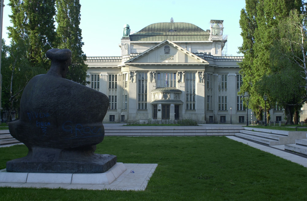
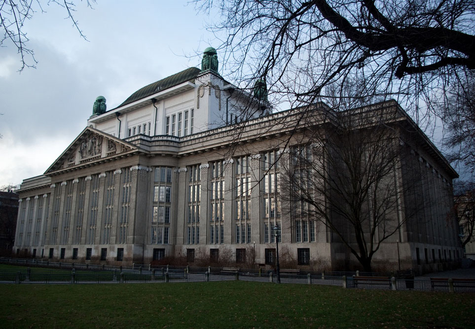
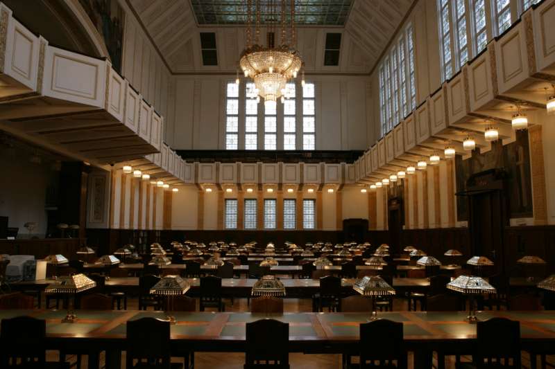
Hrvatski državni arhiv ima bogatu kartografsku zbirku, a čuva i katastarsko gradivo Državne geodetske uprave. Sastanak zainteresiranih predviđen je u četvrtak, 17. 11. 2016. u 15:00 sati ispred zagrade Arhiva u Zagrebu, Marulićev trg 16. Posjetitelji će uz stručno vođenje mr. sc. Mirjane Jurić moći razgledati Arhiv i uz kraće predavanje pogledati najvrednije planove i karte koje Arhiv čuva.
Četvrtak, 17. 11. 2016. u 17:30 OSM Geo Awareness Week - Missing Map Mapathlon
OSGL Geodetskog fakulteta, Hrvatsko kartografsko društvo i IT-sekcija Studentskog zbora Geodetskog fakulteta pozivaju Vas na druženje i učenje u sklopu OsmGeoWeek radionice na kojoj ćemo kartirati u OpenStreetMapu za humanitarne svrhe.
Radionicu organiziramo kao dio tjedna geografije, uz međunarodni dan GIS-a i 12. savjetovanje Kartografija i geoinformacije, 17. 11. 2016. s početkom u 17:30 sati na Geodetskom fakultetu Sveučilišta u Zagrebu, Kačićeva 26.
Za sudjelovanje je potrebno obaviti prijavu i ponijeti vlastito prijenosno računalo.
Pridružite nam se. Ulaz slobodan. Broj sudionika je ograničen na 40.
Petak, 18. 11. 2016., Stručni obilazak
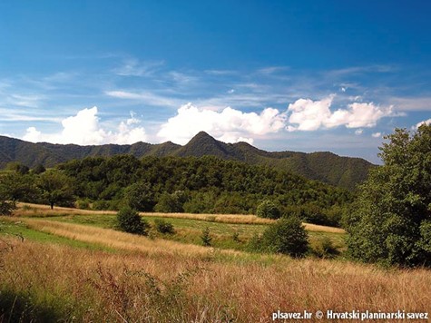
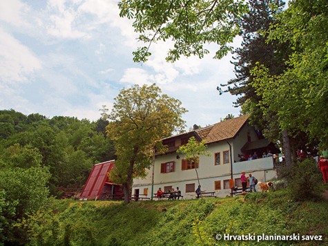
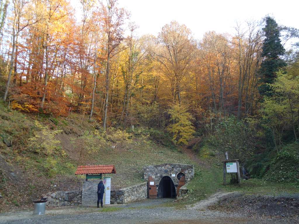
Samoborsko gorje. Iz Ruda do pl. dom Željezničar i vrha Oštrc (752 m) s posjetom rudniku sv. Barbara u Rudama. Stručni obilazak organizira Planinarska sekcija studenata Geodetskog fakulteta. Voditelj je prof. dr. sc. Drago Špoljarić. Na obilazak krećemo osobnim automobilima iz Zagreba, polazak ispred Geodetskog fakulteta u 8.30 sati. Oko 9.30 dolazak u središte Ruda, gdje je prostrano parkiralište. Do rudnika sv. Barbara idemo pješice oko 10 min. Razgledavanje rudnika uz stručno vodstvo traje oko 40 min. Nastavljamo pješice prema pl. domu Željezničar. Do doma Željezničar dolazimo oko 11.00 sati, a obližnjem vrhu Oštrc (752 m) možemo prići za 15-ak minuta po malo strmijoj stazi. Ručak je u domu od 12 do 13 sati, a nakon toga povratak u Rude drugim putem uz planinarski dom Veliki Dol. Povratak u Zagreb u poslijepodnevnim satima.
